
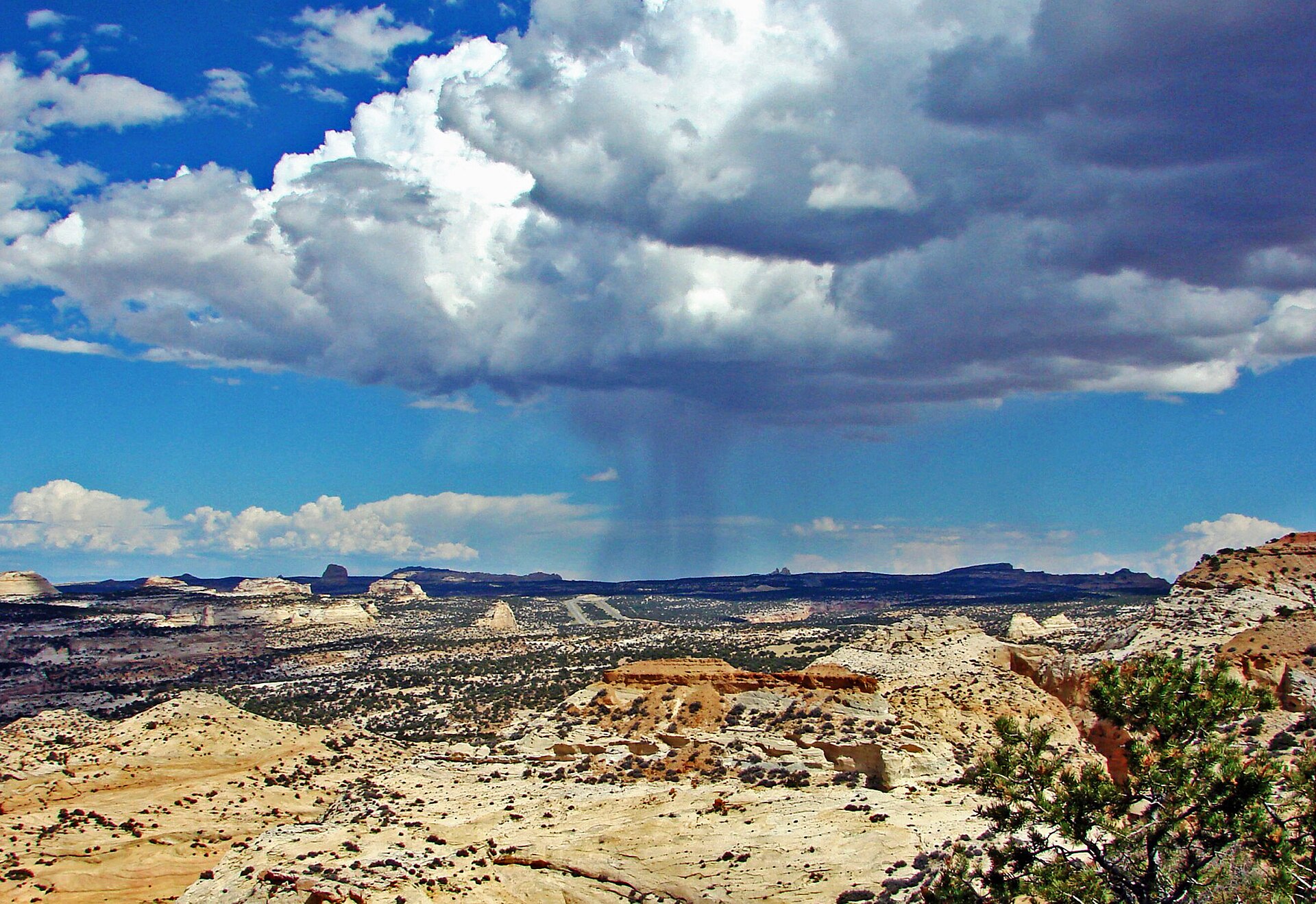
Storm moves east leaving scattered showers today; another strong system expected next weekend as forecasters monitor incoming weather-makers.

What to Know
- A cut-off low pressure system is passing through Arizona and pushing moisture into South-Central Utah on Saturday.
- Flood watches remain in effect for Canyonlands, La Sal, Abajo Mountains, and Southeast Utah through Sunday morning.
- A stronger storm system is expected to arrive next weekend following a brief break with light showers midweek.
What happened
Scattered showers and thunderstorms are expected across southeastern Utah on Saturday as a storm system moves across the Desert Southwest. The precipitation is primarily concentrated east of Interstate 15 and south of Interstate 70, with the highest chances for rain occurring in mountainous terrain and the southeast region. While most of the state will experience dry conditions today, wet weather returns to parts of Southern Utah due to a cut-off low pressure system passing through Arizona.
Outdoor recreation areas currently face a “Possible” (level 2/4) risk for flash flooding due to saturated soils in Southern Utah. Although this threat level is lower than earlier this week, the ground remains wet enough that minimal rainfall could trigger flooding in low-lying areas. A Flood Watch will remain in effect through Sunday morning for Canyonlands/Natural Bridges, La Sal and Abajo Mountains, and Southeast Utah.
Most of the rain should be over with by Saturday afternoon, but excessive runoff could persist into Sunday. The storm system is expected to continue moving east, gradually clearing the area as a brief break arrives Monday with drier conditions. A chance for another stronger storm next weekend remains possible as forecasters monitor incoming weather-makers.
According to ABC4, high temperatures on Saturday will remain in the low to mid 50s for most of the state, with slightly warmer conditions reaching the 60s only in southern spots, while a mix of sun and clouds is expected. The cut-off low pressure system passing through Arizona is specifically driving moisture into the Four Corners region and South-Central Utah, creating the conditions for thunderstorms primarily east of Interstate 15 and south of Interstate 70. Fox13Now notes that while the coverage and duration of these showers will be significantly less than the heavy precipitation seen over the past several days, isolated flash flooding remains a possibility due to the saturated ground conditions.
The National Weather Service has designated a Flood Watch through Sunday morning for specific high-risk zones including Canyonlands/Natural Bridges, the La Sal Mountains, the Abajo Mountains, and Southeast Utah. Although the flood risk level for outdoor recreation areas is currently rated as “Possible” (level 2/4), which is lower than earlier in the week, officials warn that minimal rainfall could still trigger flooding in low-lying areas given the soil saturation. Most of the rain activity is forecast to conclude by Saturday afternoon, yet excessive runoff from the storm system may persist into Sunday before clearing.
A brief break with drier conditions and temperatures near seasonal averages is expected on Monday, followed by a return to the low 60s for most valleys. However, OpenSnow indicates that while a weak storm will brush Utah midweek bringing chances for light showers, there remains a distinct possibility of another stronger storm system arriving next weekend. Fox13Now further details that a subsequent weather-maker could arrive on Tuesday from the Northwest, potentially dragging cool moist air into Northern Utah to bring isolated showers and thunderstorms to the Wasatch Front and Northern Mountains, though this system may split to only deliver cooler temperatures and increased cloud coverage. (Cool temperatures stick around this weekend, showers for some)
The cut-off low pressure system originating in Arizona is the primary driver of moisture into the Four Corners region and South-Central Utah, creating specific conditions favorable for thunderstorms east of Interstate 15 and south of Interstate 70. This atmospheric setup explains why precipitation remains concentrated in mountainous terrain and the southeast region while most of the state experiences dry conditions.
While Fox13Now notes that the coverage and duration of Saturday’s showers will be significantly less than the heavy precipitation seen over the past several days, isolated flash flooding remains a possibility due to the saturated ground conditions. The National Weather Service has designated a Flood Watch through Sunday morning for high-risk zones including Canyonlands/Natural Bridges, the La Sal Mountains, the Abajo Mountains, and Southeast Utah.
OpenSnow indicates that while a weak storm will brush Utah midweek bringing chances for light showers, there remains a distinct possibility of another stronger storm system arriving next weekend. Additionally, Fox13Now details that a subsequent weather-maker could arrive on Tuesday from the Northwest, potentially dragging cool moist air into Northern Utah to bring isolated showers and thunderstorms to the Wasatch Front and Northern Mountains.
What is known
A storm system currently moving east across the Desert Southwest is expected to spread scattered showers and thunderstorms into eastern Utah by Sunday, according to Fox 13 Now. While the coverage and duration of these precipitation events will be significantly less than what the state experienced over the previous several days, forecasters note that isolated flash flooding cannot be ruled out in affected areas.
The National Weather Service has identified a cut-off low pressure system passing through Arizona as the driver pushing moisture across the Four Corners region and into South-Central Utah. Thunderstorms are slated to appear primarily east of Interstate 15 and south of Interstate 70, with the highest chances for precipitation occurring in the southeast and within mountainous terrain.
Saturated soils across Southern Utah mean that even light rainfall could trigger flooding in low-lying areas, prompting a Flood Watch through Sunday morning for Canyonlands, Natural Bridges, La Sal, Abajo Mountains, and Southeast Utah. Outdoor recreation areas currently face a level 2 out of 4 risk for flash flooding, which is lower than earlier this week but still requires weather awareness.
A separate weather-maker system is expected to arrive on Tuesday, potentially bringing isolated showers and thunderstorms to the Wasatch Front and Northern Mountains. This incoming system may originate from the Northwest and drag cool moist air into Northern Utah, though forecasters indicate it could split and result in only cooler temperatures and increased cloud coverage rather than widespread rain.
Temperatures for the current weekend are running roughly 5 to 10 degrees below average, with highs topping out in the low to mid-50s for most of the state. While a brief break with drier conditions is expected on Monday as temperatures return near seasonal averages, the potential for additional precipitation remains a key factor for the upcoming week.
The National Weather Service has designated a Flood Watch through Sunday morning specifically for the Canyonlands, Natural Bridges, La Sal, and Abajo Mountains regions, as well as Southeast Utah. This alert underscores the heightened risk posed by saturated soils across Southern Utah, where even light rainfall is sufficient to trigger flooding in low-lying areas. The current flash flood risk for outdoor recreation areas stands at a level 2 out of 4, described as “Possible,” which represents a decrease from earlier in the week but still necessitates weather awareness for those planning activities.
While most of the rain associated with the cut-off low pressure system is expected to conclude by Saturday afternoon, excessive runoff may persist into Sunday. The immediate forecast calls for mostly sunny to partly cloudy skies on Saturday with temperatures remaining cool, topping out in the 50s. Conditions are projected to improve further by Monday, with valleys returning to the low 60s and dry weather prevailing across most of the state.
Looking ahead to Tuesday, a new weather-maker system may arrive from the Northwest, dragging cool moist air into Northern Utah. This incoming system has the potential to bring isolated showers and thunderstorms to the Wasatch Front and Northern Mountains. However, forecasters indicate the storm could split, resulting in only cooler temperatures and increased cloud coverage rather than widespread rain. Regardless of whether precipitation occurs, the event is not expected to be widespread, though it remains a factor for those with outdoor plans.
According to the ABC4 forecast, a cut-off low pressure system passing through Arizona is actively pushing moisture across the Four Corners region and into South-Central Utah. This specific atmospheric setup drives thunderstorms primarily east of Interstate 15 and south of Interstate 70, with the highest probability for precipitation occurring in the southeast and within mountainous terrain.
While most of the rain associated with this system is expected to conclude by Saturday afternoon, excessive runoff may persist into Sunday. The immediate forecast calls for mostly sunny to partly cloudy skies on Sunday with temperatures remaining cool, topping out in the 50s.
Key details and context
A cut-off low pressure system is passing through Arizona, pushing moisture across the Four Corners region and into South-Central Utah. This atmospheric setup drives wet weather to parts of Southern Utah while most other areas experience a mix of sun and clouds. Thunderstorms are expected mostly east of Interstate 15 and south of Interstate 70, with the highest chances for precipitation occurring in the southeast and mountainous terrain.
Scattered showers will continue today as the storm gradually moves east and out of the area. Chances for these showers could persist into Sunday before conditions enter a break period. While most rain should conclude by Saturday afternoon, excessive runoff from saturated soils may hold over into Sunday in low-lying areas of Southern Utah.
A flood watch remains in effect through Sunday morning for Canyonlands, Natural Bridges, the La Sal and Abajo Mountains, and Southeast Utah. Outdoor recreation areas currently face a level 2 out of 4 risk for flash flooding due to these saturated conditions. Although this threat is lower than earlier in the week, weather awareness remains necessary as even light rain can trigger runoff.
According to ABC4 meteorologists, the atmospheric setup involves temperatures running roughly 5-10 degrees below average, with highs topping out in the low to mid 50s across most of the state and reaching only a few 60s in the warmer southern spots. This cool air mass accompanies the cut-off low pressure system moving through Arizona, which is responsible for pushing moisture into South-Central Utah and creating wet weather conditions specifically east of Interstate 15 and south of Interstate 70. The highest probability for precipitation remains concentrated in the southeast region and within mountainous terrain where saturated soils mean that even minimal rainfall can trigger flooding in low-lying areas.
The risk profile for outdoor recreation areas is currently classified as level 2 out of 4, described by forecasters as “Possible” for flash flooding. While this threat level is lower than earlier in the week, officials emphasize that weather awareness remains critical because the ground’s saturation reduces the threshold required to generate runoff. A Flood Watch has been officially extended through Sunday morning covering Canyonlands National Park, Natural Bridges National Monument, the La Sal Mountains, and Southeast Utah generally.
Looking beyond the immediate weekend, conditions are expected to shift toward a break period with mostly sunny to partly cloudy skies on Sunday. Temperatures will remain on the cooler end of the spectrum for that day, capping out in the 50s before returning to the low 60s for most valleys by Monday. The forecast indicates dry weather will persist through Monday as well, though a new system could arrive on Tuesday from the Northwest to drag cool moist air into Northern Utah. This potential midweek development might bring isolated showers and thunderstorms to the Wasatch Front and Northern Mountains, or alternatively split to deliver only cooler temperatures and increased cloud coverage without widespread precipitation.
As noted in daily snow reports, while scattered showers will continue today as the storm moves eastward out of the region, chances for these showers could persist into Sunday before a break period sets in. A weak storm is anticipated to brush Utah midweek with only light shower possibilities, followed by a chance for another stronger storm system next weekend. Residents are advised that excessive runoff from saturated soils may continue to hold over into Sunday in low-lying areas of Southern Utah even after the rain concludes by Saturday afternoon. (Another Snow Teaser and Impressive Rain Storm)
The atmospheric dynamics driving this event involve a cut-off low pressure system originating in Arizona that transports moisture across the Four Corners region directly into South-Central Utah. This specific configuration creates a distinct weather divide where wet conditions are concentrated east of Interstate 15 and south of Interstate 70, while the majority of the state remains under a mix of sun and clouds with temperatures running 5 to 10 degrees below average.
As the storm system gradually migrates eastward out of the region today, scattered showers will persist across affected areas. While the primary precipitation event is expected to conclude by Saturday afternoon, the hydrological impact continues as excessive runoff from saturated soils may linger into Sunday in low-lying zones of Southern Utah, maintaining a level 2 flash flood risk for outdoor recreationists.
Looking further ahead, the forecast indicates a transition to drier conditions with mostly sunny to partly cloudy skies on Sunday and temperatures capping in the 50s before rising to the low 60s by Monday. A new weather-maker is anticipated to arrive from the Northwest on Tuesday, potentially dragging cool moist air into Northern Utah to bring isolated showers or thunderstorms to the Wasatch Front, though this system may split to deliver only cooler temperatures and increased cloud coverage without widespread precipitation.
What the reporting and records show
A cut-off low pressure system currently passing through Arizona is pushing moisture across the Four Corners region, creating conditions where thunderstorms are slated to be seen mostly east of I-15 and south of I-70. This activity affects parts of Southern Utah while most of the state remains dry with temperatures running roughly 5 to 10 degrees below average. The highest chances for precipitation today are concentrated in the southeast and within mountainous terrain, where saturated soils increase the risk of flooding in low-lying areas.
While a mix of sun and clouds is expected for most of the state, wet weather returns specifically to parts of Southern Utah as the system moves eastward. A Flood Watch remains in effect through Sunday morning for Canyonlands/Natural Bridges, La Sal and Abajo Mountains, and Southeast Utah due to these conditions. Although outdoor recreation areas currently face a “Possible” level 2 risk for flash flooding, this threat is lower than earlier in the week but still warrants weather awareness.
Chances for showers could continue into Sunday before the area enters a break in the weather pattern as the storm gradually moves east and out of the region. Most of the rain should conclude by Saturday afternoon, though excessive runoff from saturated soils may persist into Sunday morning. A weak storm is expected to brush Utah midweek with chances for light showers, followed by a chance for another stronger storm next weekend.
The meteorological setup driving these conditions involves a cut-off low pressure system originating in Arizona, which is actively transporting moisture across the Four Corners region and into South-Central Utah. This specific trajectory concentrates precipitation risks primarily east of Interstate 15 and south of Interstate 70, creating a distinct wet zone within an otherwise dry state where temperatures remain roughly 5 to 10 degrees below average. Highs for Saturday are projected to reach only the low to mid-50s across most of the state, with slightly warmer conditions in the southern regions reaching into the 60s.
While the immediate threat of widespread rain diminishes by Saturday afternoon as the system moves eastward, the hydrological impact persists due to pre-existing saturated soils. This saturation means that even minimal additional rainfall can trigger flooding in low-lying areas and generate excessive runoff that may continue through Sunday morning. Consequently, a Flood Watch remains active for specific high-risk zones including Canyonlands/Natural Bridges, the La Sal and Abajo Mountains, and Southeast Utah.
Looking beyond the immediate weekend, the forecast indicates a temporary respite before the next weather-maker arrives on Tuesday or Wednesday. A system potentially sweeping in from the Northwest could introduce cool, moist air to Northern Utah, though it may split, resulting in either isolated showers and thunderstorms along the Wasatch Front and Northern Mountains or merely cooler temperatures with increased cloud cover. Following this midweek event, conditions are expected to return to the low 60s before another stronger storm system becomes a possibility for next weekend.
The meteorological mechanism driving this localized precipitation involves a cut-off low pressure system originating in Arizona that actively transports moisture across the Four Corners region and into South-Central Utah. This specific trajectory concentrates thunderstorm activity primarily east of Interstate 15 and south of Interstate 70, creating a distinct wet zone within an otherwise dry state where temperatures remain roughly 5 to 10 degrees below average.
What it means and what to watch
A Flood Watch remains in effect through Sunday morning for Canyonlands, Natural Bridges, La Sal Mountains, Abajo Mountains, and Southeast Utah. This alert reflects saturated soils across Southern Utah, where even modest rainfall can trigger flooding in low-lying areas. The risk for flash flooding is currently rated as “Possible” (level 2/4) at outdoor recreation sites, a reduction from earlier in the week but still requiring weather awareness.
While most of the rain should clear by Saturday afternoon, excessive runoff may persist into Sunday. Residents and visitors are advised to monitor conditions closely before heading out, particularly if planning activities during the weekend break. The current system is moving eastward, leaving a window for drier skies on Sunday as temperatures remain in the 50s.
Looking ahead, a weak storm is expected to brush Utah midweek, bringing chances for light showers. This incoming system may bring isolated precipitation or simply cooler temperatures and increased cloud coverage depending on how it develops. Residents should continue watching forecasts for updates on this potential weather-maker arriving Tuesday or later in the week.
The cut-off low pressure system driving this event is currently positioned over Arizona, pushing moisture across the Four Corners region and into South-Central Utah. This specific atmospheric setup creates a distinct precipitation gradient, with thunderstorms slated primarily east of Interstate 15 and south of Interstate 70. Consequently, the highest probabilities for rainfall are concentrated in the southeast quadrant of the state and within mountainous terrain where orographic lift enhances precipitation efficiency.
While the immediate threat diminishes by Saturday afternoon as the system moves eastward, the hydrological impact persists through Sunday due to ground saturation. The ABC4 forecast notes that temperatures will remain on the cooler end for the weekend, with highs topping out in the 50s, before returning to the low 60s for most valleys starting Monday. This pattern of cool, dry conditions is expected to continue into Monday, providing a brief respite from the wet weather.
The upcoming midweek system presents a variable scenario that could either deliver isolated showers and thunderstorms or simply introduce cooler temperatures with increased cloud coverage. If the system approaches from the Northwest as modeled, it may drag moist air into Northern Utah, potentially affecting the Wasatch Front and Northern Mountains. However, forecasters note the possibility of this storm splitting, which would limit precipitation to just a temperature drop and overcast skies rather than widespread rain.
In contrast to the current localized flood threat in Southern Utah, the broader state is entering a break from significant weather activity after scattered showers gradually move out of the area. While there is a chance for another stronger storm next weekend, the immediate focus remains on monitoring the residual runoff and the potential for isolated precipitation as the weak midweek system approaches.
The atmospheric mechanism driving the current event involves a cut-off low pressure system anchored over Arizona, which is actively transporting moisture across the Four Corners region and into South-Central Utah. This specific configuration establishes a distinct precipitation gradient, with thunderstorms primarily forecast east of Interstate 15 and south of Interstate 70.